
Knowledge and capacity for better water resources management in Chad (ResEau III)
In Chad, ResEau III supports the transition towards autonomous, knowledge-based Integrated Water Resource Management (IWRM) to strengthen the country’s long-term resilience to climate variability.
Chad faces acute and growing vulnerability to climate variability, with water resources under increasing pressure from erratic rainfall, population growth and the degradation of agro-pastoral systems. A fundamental barrier to effective water-sector planning has been the chronic shortage of reliable hydrogeological data and the limited institutional capacity to produce, manage and disseminate such data sustainably.
The “Production of Knowledge and Institutional Support for Integrated Water Resource Management in Chad, ResEau (Phase III)” project builds on two earlier phases of Swiss cooperation in the water sector and pursues three key objectives. First, it improves interventions in the water sector by ensuring the continuous production, availability and accessibility of relevant hydrogeological maps and data tailored to specific areas. Second, it strengthens the institutional and technical capacities of the Documentation and Geographic Information Center (CDIG) and other ministerial bodies, such as the National Laboratory of Chad (LNE), enabling them to provide services autonomously, disseminate products and support decision-making in the water and agro-pastoral sectors. Third, it anchors the Master’s programme in Hydrogeology and Geographic Information Systems (HydroSIG) at the University of N’Djamena by expanding its scope and practical training and enabling it to continue producing qualified graduates independently.
Areas of Expertise
- Water
- Water Resource Management
- Natural Resource Management
Companies
Dorsch Impact
Client
SDC (Swiss Agency for Development and Cooperation)
Duration
From 2024 to 2028
Location
Chad
Project Activities
Hydrogeological Knowledge Production
- Collecting, analysing, and processing geological, hydrogeological, geophysical, and hydrochemical data across central and southern Chad
- Processing satellite imagery and GIS data to support spatial analysis
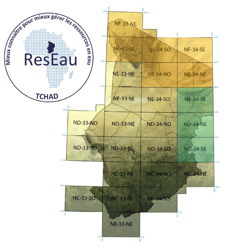
- Drafting and editing 13 hydrogeological maps at 1:500,000 / 1:200,000 scale
- Preparing detailed explanatory notes to accompany each hydrogeological map
Institutional Component
- Supporting the institutional development of the CDIG across key dimensions: organisational structure, governance and management, strategic planning, monitoring and evaluation, and financial sustainability
- Strengthening the capacities of staff at the Ministry of Water (CDIG, LNE, Water Resource Deartment) in the areas of data collection, processing, analysis, and storage
- Developing or modernise IWRM products including water analysis equipment, hydrogeological maps, databases, data collection applications, and a geoportal
- Establishing standards for data quality control, documentation, and knowledge management
- Facilitating collaboration and partnership frameworks with national and international actors
Technical Component
- Reviewing and adjusting the existing Master's programme in Hydrogeology and Geographic Information Systems to align with the University of N'Djamena's academic mission and strategic goals
- Providing technical and material support to programme leaders and lecturers in developing and delivering practical teaching modules (Development of a hydrogeological experimental site and a water analysis laboratory)
- Training academic staff in various subjects and pedagogical methods
- Supporting the long-term institutional anchoring of the master’s programme to ensure autonomous operation beyond project duration
Fund Management
- Administering an approximately CHF 4 million fund to support project implementation and partnerships across components
Impact
- Enhanced climate resilience: The project directly strengthens Chad's capacity to anticipate and respond to climate variability through the systematic production and dissemination of hydrogeological knowledge, supporting evidence-based planning across the water and agro-pastoral sectors.
- Improved decision-making for IWRM actors: Government institutions, development partners, humanitarian organisations, and the private sector gain access to tailored, up-to-date maps and data products (SITEAU App and Geoportal), enabling more effective and coordinated interventions in the water sector.
- Sustainable institutional capacity: The CDIG is positioned to independently produce and disseminate IWRM products beyond the project lifecycle, establishing a durable national infrastructure for water resource data management.
- Qualified national expertise: The HydroSIG Master's programme at the University of N'Djamena is expected to continue producing qualified graduates in hydrogeology and GIS autonomously, building Chad's long-term human capital in the water sector.
Contributing to the UN Sustainable Development Goals
We are committed to making a positive impact and supporting the UN Sustainable Development Goals (SDGs). This project contributes to the following SDGs:


Companies
